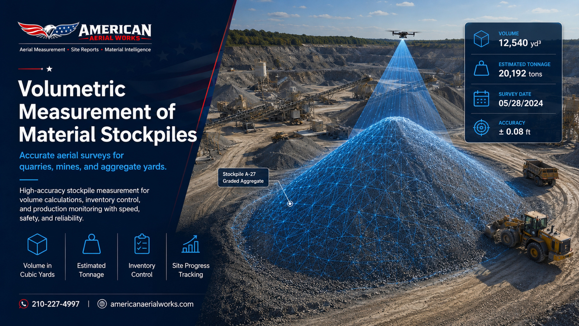
Drone Stockpile & Haul-Off Measurement Reports
Accurate aerial volume reports for construction sites, asphalt operations, roll-off cleanup, demolition debris, quarries, mines, and material yards.
American Aerial Works uses drone mapping and aerial site documentation to help contractors measure material piles, estimate tons, track haul-off progress, verify remaining volume, and generate clear visual reports for billing, planning, and operations.
Stop Guessing Material Volume
On construction sites, asphalt yards, demolition projects, roll-off cleanup jobs, and quarry operations, material volume is often estimated by eye. That creates problems:
Aerial measurement gives your team a clear visual record and a measurable number to work from.
- ×Inaccurate haul-off estimates
- ×Disputes over how much material was removed
- ×Unclear remaining volume
- ×Billing disagreements
- ×Poor production tracking
- ×Missed inventory changes
- ×Delays in planning trucks, equipment, and crews
Built for Real Jobsite Problems
Dive deeper into each part of what American Aerial Works offers.
Services
Stockpile volume, haul-off, asphalt millings, quarry inventory, and more.
Learn MoreIndustries
Construction, asphalt, demolition, roll-off, quarries, material yards.
Learn MoreHow It Works
Schedule, fly, calculate, and deliver a clean visual report.
Learn MoreReports
Aerial overviews, pile outlines, volume estimates, before & after.
Learn MoreService Area
Central Texas: Austin, San Marcos, Waco, Killeen and surrounding.
Learn MoreContact
Tell us about your site and we'll get back with availability.
Learn MoreReady to Measure Your Site?
Request a quote for a one-time measurement, recurring monthly reports, or project-based haul-off tracking.